 Lighthouse Property Tax fight Settled Against Hull
By Christopher R. Vaccaro
Special to Banker & Tradesman

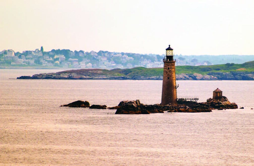
Graves Ledge is a 10-acre rock formation at the edge of Boston Harbor, miles from the mainland. A lighthouse there has guided ships entering Boston Harbor since 1905. The United States owned and operated Graves Ledge and the lighthouse until it sold them to David Waller in 2013 for almost $1 million.
Waller acquired ownership of Graves Ledge and the lighthouse through a limited liability company, and recorded a deed with the Suffolk County Registry of Deeds. The deed describes Graves Ledge as “the outermost island in the Boston Harbor National Recreation Area, in Suffolk County, Massachusetts Bay.” The U.S. Coast Guard reserved the right to operate navigational aids on Graves Ledge, and the deed requires the new owner to preserve historic buildings. Waller is currently renovating the lighthouse and related structures.
After the purchase, Waller received a real estate tax bill from the Town of Hull, located in Plymouth County. Waller contested Hull’s jurisdiction in the land court. The court offered the municipalities of Boston, Winthrop and Nahant opportunities to assert jurisdiction over Graves Ledge, but they hastily renounced any claim to it, probably hoping to avoid responsibility for providing municipal services to the remote ledge. Last month, after a trial involving scores of documents and expert testimony from surveyors, the court ruled that Graves Ledge lies outside of Hull’s municipal boundaries.
Early Colonial Records Consulted
The land court’s decision relied on historical records for the Boston Harbor Islands and Hull. In 1641, the Massachusetts Bay Colony established a fishing community known as “Nantascot” on the peninsula and neighboring islands today known as Hull. The town was originally part of Suffolk County. Colonial records show that the Brewster Islands, a small archipelago north of Hull’s peninsula, had been awarded to Hull by 1662. Seventeenth century maps of Boston Harbor show the Brewster Islands as enclosed shapes, and Graves Ledge as a series of x’s northeast of the Brewster Islands.
Hull was annexed to Plymouth County in 1803. Decades later, the Massachusetts legislature created a commission to determine the seaward boundaries of coastal municipalities. The commission issued a report in 1884 setting the marine boundaries of towns in Norfolk and Plymouth Counties, and showed Graves Ledge and the Brewster Islands outside of Hull’s boundaries.
What Counts as an Island?
In 1892, the Massachusetts Supreme Judicial Court considered Hull’s marine boundary and the 1884 report in Russ v. Boston, where the city of Boston attempted to assess taxes on one of the Brewster Islands. The SJC ruled that although the report concluded that the island was located north of Hull’s marine boundary, the island itself remained part of Hull because of the seventeenth century colonial grant.
During the 20th century, numerous maps and documents were produced by private parties and government agencies regarding coastal municipalities near Boston Harbor. Many of these showed Graves Ledge within Plymouth County, but some showed it in Suffolk County. Because of these inconsistencies, the court focused on the seventeenth century colonial grants involving the Brewster Islands.
The court observed that colonial maps and later maps labeled Graves Ledge separately from the Brewster Islands, and that no documents from colonial times included Graves Ledge in the Brewster Islands. The court cited Hull’s own records, which only mentioned four islands among the Brewster Islands, none of which was Graves Ledge. These records also described a “meadow” located on the northernmost Brewster Island. There are no meadows on rocky and barren Graves Ledge, which lies well north of the vegetated Brewster Islands.
The court noted that Graves Ledge apparently was not considered an island during colonial times. Early maps do not label Graves Ledge as an island, and show it as a series of X’s, while showing the Brewster Islands as enclosed shapes designated as islands. The court also discussed Graves Ledge’s remoteness from the Brewster Islands, its uninhabitability before the lighthouse was built, and its location beyond the traditional outer boundary of Boston Harber running between Nahant and the Hull peninsula. Given these findings, the court ruled that Graves Ledge was outside of Hull’s corporate boundaries.
As to Boston, Winthrop and Nahant renouncing claims to Graves Ledge, the court speculated on whether it is possible for land within the boundaries of Massachusetts to be outside the boundaries of all cities and towns. The court declined to answer that question, because its rejection of Hull’s claim to Graves Ledge disposed of the case at hand. If the question arises later, the city of Boston may end up as a reluctant party to its resolution.
Download the article as seen in Banker & Tradesman on June 26, 2023. Learn more about Christopher R. Vaccaro.